The Pyramids of Greece
The so-called ‘pyramids’ of Greece, found mainly in the Argolid plain of the Peloponnese, form a distinctive group of ancient structures that modern researchers analyse to understand trade and defence network patterns. The best-preserved example is the Pyramid of Elliniko which stands 42 metres tall. It’s strategic position allowed the stone installation to control access along the historical passes connecting the Argolic coast with the Arcadian hinterland.
Taken together, the textual, archaeological, and archaeometric evidence points to a complex regional building tradition developed by native Aegean builders. Modern scholarship generally separates these structures from dynastic Egyptian funerary architecture and interprets them instead as specialised local installations, most likely connected with military defence or agricultural control.
Architectural Typology of Greek Pyramids: Comparing Elliniko, Lygourio, and Viglaphia
The Pyramid of Elliniko is a small, freestanding structure featuring a rectangular baseline foundation. Its external limestone walls rise at an incline of approximately 60 degrees. It could easily be mistaken for a pyramid. Unlike true dynastic Egyptian pyramids, however, these sloping masonry walls do not meet at a pointed apex. Instead, the courses stop at a vertical height of roughly 3.5 metres, where archaeological evidence indicates they supported either a flat upper platform or the structural foundations of a vertical upper storey (Lord, 1938). The masonry is composed entirely of local grey limestone blocks, meticulously cut in a carefully fitted trapezoidal-to-partly-polygonal style and laid flush without the application of mortar.
The Pyramid of Elliniko is not an isolated example of this architectural phenomenon. Several comparable pseudo-pyramidal structures have been recorded across the Peloponnese peninsula and surrounding regions of Greece:
- The Pyramid of Lygourio: Located near the Ancient Theatre of Epidaurus. Only the sandstone foundations of this structure remain extant today. Its baseline dimensions closely mirror those of the Pyramid of Elliniko, and it features similar pseudo-pyramidal sloping profiles.
- The Pyramid of Dalamanara: Also located within the Argolid plain, of which only trace foundations survive adjacent to modern agricultural boundary lines.
- The 'Pyramid' of Viglaphia: Situated in Laconia on a coastal cliff overlooking the Elaphonisos Strait, is a very weathered, truncated conical or pseudo-pyramidal stone structure.
- The Amphieion at Thebes: Located in Boeotia, this monument consists of a stepped earthen mound rather than a stone-block masonry pyramid, though it has occasionally entered comparative discussions regarding prehistoric monumental earthworks in mainland Greece.
Classical Historiography: Pausanias, the Corinthiaka, and the Myth of Proetus and Acrisius
The primary ancient literary source addressing pseudo-pyramidal monuments in the Argolid region is Pausanias, the 2nd-century CE Greek geographer and traveller. In his topographic work Description of Greece (specifically the text known as the Corinthiaka, 2.25.7), Pausanias documents a distinct, stone-built landmark situated along the active thoroughfare connecting the city-states of Argos and Epidaurus:
"On the way from Argos to Epidauria there is on the right a building made very like a pyramid, and on it in relief are wrought shields of the Argive shape. Here took place a fight for the throne between Proetus and Acrisius... For those that fell on either side was built here a common tomb (polyandrion)..." (Pausanias, trans. Jones, 1918).
Pausanias also makes reference to a secondary communal mass grave or polyandrion constructed for the elite Argive hoplites who successfully routed the invading Spartan phalanx at the historic Battle of Hysiae in 669 BCE (Corinthiaka, 2.24.7), an engagement centred near the border fort of Hysiae near the modern village of Achladokampos.
Although the textual evidence of Pausanias explicitly links a pseudo-pyramidal architectural layout to a collective military tomb, modern historical geography and topographic surveying dictate analytical caution before treating this account as an accurate description of the standing stone monument at Elliniko. The spatial path charted in the Corinthiaka positions the described monument directly on the eastern road descending toward Epidaurus, which places the passage in closer spatial alignment with the surviving sandstone foundations at Lygourio. Conversely, the Pyramid of Elliniko sits on the starkly distinct southwestern military route trailing through the mountain passes toward Tegea in ancient Arcadia (Lord, 1938). Consequently, while the testimony of Pausanias establishes that pseudo-pyramidal architectural designs functioned prominently within localized indigenous memory as elite funerary markers or heroic monuments, this specific ancient narrative cannot be specifically related to the physical structure at Elliniko itself.
Excavation Stratigraphy: Material Artifacts, Wiegand (1901), and Louis E. Lord (1938)
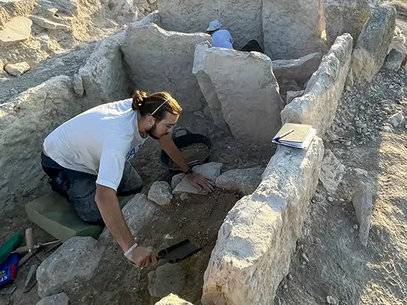
Systematic stratigraphical excavations of the Pyramid of Elliniko began at the turn of the 20th century under the direction of the German archaeologist Theodor Wiegand (Wiegand, 1901) and were expanded significantly by Louis E. Lord in conjunction with the American School of Classical Studies at Athens during field campaigns in the late 1930s (Lord, 1938; 1939). The primary objective of these archaeological investigations was to determine whether the structural horizons contained evidence of elite civic burials or prehistoric occupation phases.
The artefactual assemblages recovered from the interior living floors and the immediate exterior foundations do not match the material culture patterns typical of an elite Bronze Age or Archaic period burial. Osteological remains, military weaponry, and precious metallic grave goods are entirely absent from the site. Instead, the collected material points to ordinary domestic occupation, architectural reuse, and prolonged depositional disturbance:
- Classical to Hellenistic Pottery: Field teams recovered a substantial volume of functional domestic ware, including terracotta oil lamps, household plates, and ceramic fragments of a large, thick-walled pithos (storage jar) structurally embedded within the primary interior floor context (Lord, 1938).
- Prehistoric Material Culture: Scattered Early Helladic II ceramic sherds, dating to circa 2800 – 2500 BCE, were identified by the American archaeologist Saul Weinberg within the deeper soil matrices and the lower exterior foundations resting directly adjacent to the natural limestone bedrock (Weinberg, cited in Lord, 1938).
- Late Antiquity Intrusion: Minor chronological markers consisting of Roman lamps and Proto-Christian coarse utilitarian wares were documented in upper strata, pointing to a long, disrupted period of residential or military re-use.
The overall architectural layout of the limestone building also weakens a funerary interpretation. The southeastern entrance portal leads directly into a narrow, recessed corridor, which then turns sharply at a right angle into a single square room. Louis E. Lord (1938) observed that the structural sockets of the doorway mechanism were explicitly arranged to lock and secure exclusively from the inside. This internal security detail is highly difficult to reconcile with a permanently sealed tomb monument, but it fits perfectly with the defensive profile of an active military guard post or tactical installation.
Chronological Debate: Classical Hellenistic Consensus vs. Prehistoric Luminescence Dating
The absolute chronology of the Pyramid of Elliniko remains one of the most contentious scientific debates in Aegean archaeology, splitting contemporary scholars into two distinct methodological camps. This chronological divide opposes traditional ceramic-based architectural seriation against experimental physics-based absolute dating applications to resolve when the structure was erected and why.
Late Classical Horizon: The Late 4th-Century BCE Border Fortress Consensus
The dominant consensus among mainstream archaeologists dates the construction of the monument to the Late Classical or early Hellenistic period, specifically the late 4th century BCE (Sampson, 1996). This chronological attribution is directly supported by the diagnostic domestic pottery found within the primary structural bedding layers, as well as by the architectural style of the masonry itself. The trapezoidal and polygonal limestone construction techniques closely mirror those found in known regional watchtowers, phryctoriae (fire-signalling towers), and small border fortresses (byporgoi) erected across the Peloponnese during the geopolitical conflicts involving Argos, Sparta, and the Kingdom of Macedonia. Under this interpretive framework, the underlying Early Helladic II ceramic fragments are classified as residual material from an older, unfortified prehistoric settlement that was cleared and disturbed when the Late Classical foundations were cut into the bedrock.
Early Helladic II Timeline: The Ioannis Liritzis Optical Thermoluminescence (TL/OSL) Hypothesis
During the 1990s, an alternative research team led by the Greek physicist Ioannis Liritzis applied a novel variation of Optical Thermoluminescence (TL) and Optically Stimulated Luminescence (OSL) dating directly to the carved internal contact surfaces of the megalithic limestone blocks (Theochari et al., 1995; Liritzis, 1997). This laboratory technique measures the accumulated ionizing radiation trapped within the crystalline lattice of the stone since the block faces were last exposed to direct sunlight during ancient quarrying, dressing, and structural placement. The experimental results yielded remarkably early absolute calendar dates:
- Pyramid of Elliniko: 2730 ± 720 BCE (Theochari et al., 1995).
- Pyramid of Lygourio: 2260 ± 710 BCE (Liritzis, 1997).
If these high-chronology dates are accepted, these Aegean structures would stand as contemporary with, or older than, the Old Kingdom monuments of Egypt, including the Step Pyramid of Djoser at Saqqara and the Great Pyramid of Giza. Such an early dating would significantly challenge conventional diffusionist models of Mediterranean architectural development. Ioannis Liritzis and his collaborators further proposed that the original astronomical orientation of the southeastern entrance corridor aligned precisely with the rising of Orion’s belt between 2400 – 2000 BCE, implying an intentional prehistoric ritualistic or observational function.
Methodological Criticisms: Bleaching Anomalies and Stratigraphic Disturbance in Sample Analysis
The wider international archaeological community has generally rejected this prehistoric chronology on strict stratigraphic and methodological grounds. Critics such as Adamanthios Sampson (1996) argue that surface luminescence dating of exposed stone architecture is frequently compromised by partial bleaching anomalies, which occur if the component limestone blocks were exposed to sunlight during undocumented phases of structural repair, partial dismantling, or historic clearing. The measurement process also carries a very wide margin of error (± 720 years). Given the documented history of mixed, disturbed stratigraphy at the site, experimental physical dating of the stone surfaces alone is not considered methodologically robust enough to overturn the established 4th-century BCE architectural typology in the absence of sealed, undisturbed Early Helladic II structural layers.
Military Engineering Functions: Argolic Gulf Defenses, Watchtowers, and Phryctoriae
Rather than reflecting a direct dynastic Egyptian cultural connection, the physical remains of the Pyramid of Elliniko fit best within the structural context of localized Greek military engineering. Its specific geographic position, overlooking the Argolic Gulf and controlling the strategic mountain choke points toward Arcadia, supports the academic interpretation of the building as a heavily fortified watchtower, defensive blockhouse, or garrisoned border outpost. The distinctive, sloping pseudo-pyramidal masonry base served a practical engineering purpose, functioning as a structural battering-ram buffer or a sloped fortification wall designed to resist scaling attempts by enemy infantry forces while providing seismic stability to the superstructure.
The flat upper platform or vertical timber upper-storey foundations would have supported sentry guards, defensive projectiles, and fire-signalling equipment. This layout directly links the installation to the wider network of Peloponnesian phryctoriae, which allowed Greek garrisons to rapidly transmit emergency military information across vast distances using controlled torch beacons. In this historical reading, the Pyramid of Elliniko is less an exotic, imported architectural transplant than a rational, well-preserved example of the varied and experimental military architecture deployed during the Hellenistic period to secure regional territorial borders.
Authors Note
The Pyramid of Elliniko is an open site so please be respectful and also take care when exploring the ruins.
References and Further Reading
- Liritzis, I., 1997. Dating of Two Hellenic Pyramids by a Novel Application of Thermoluminescence, Journal of Archaeological Science, 24(5), pp. 399–407.
- Lord, L.E., 1938. The "Pyramids" of Argolis, American Journal of Archaeology, 42(4), pp. 508–538.
- Lord, L.E., 1939. Watchtowers and Fortresses in Argolis, American Journal of Archaeology, 43(1), pp. 78–84.
- Pausanias, 1918. Description of Greece. Translated by W.H.S. Jones. London: William Heinemann Ltd.
- Sampson, A., 1996. 'The Pyramid of Elliniko and the Mythology of Argolis', Archaiologia, 60, pp. 56–61.
- Theochari, M.S., Liritzis, I. and Galloway, R.B., 1995. 'Dating of Two Hellenic Pyramids by Thermoluminescence', Comptes Rendus de l'Académie des Sciences, Série II, 320, pp. 609–614.
- Wiegand, T., 1901. 'Die Pyramide von Kenchreai', Athenische Mitteilungen, 26, pp. 241–246.